
Electoral Area C: Discovery Islands – Mainland Inlets Official Community Plan (OCP)
Project Launch
The Strathcona Regional District (SRD) is pleased to announce that work toward a new Official Community Plan for Electoral Area C is beginning Fall 2024, and we need your input!
What is an Official Community Plan (OCP)?
- Communicates a community’s vision, goals, and objectives;
- Reflects the community’s social, environmental, and economic interests over the long term;
- Outlines long term plans for a community; and
- Guides planning and land use management.
The current OCP was adopted in 2007 and the new OCP will need to reflect the needs and vision of the current community and address modern challenges.
See your community’s existing OCP linked here:
- Quadra Island Official Community Plan, 2007 (Bylaw No.3050)
- Desolation Sound Rural Land Use Bylaw, 1993 (Bylaw No. 1460)
Community involvement is key to ensure the OCP reflects the ideas and input of the people who live and work in Electoral Area C and speaks to the unique context of local concerns.
How does the OCP relate to other plans?
The Local Government Act enables regional districts to adopt OCPs. OCPs set the overarching planning framework for the planning area and local area plans. OCPs are informed by a community’s Integrated Community Sustainability Plan and Housing Needs Report and are implemented through a Zoning Bylaw. The goals, objectives, and policies of an OCP set the stage and provide broad guidance for future planning and development. OCPs inform future local area plans, such as the Quathiaski Cove Village Plan, and other regulatory documents such as the zoning bylaw. Following the adoption of the OCP, other bylaws undertaken must be consistent with the Plan. You can think of an OCP like an umbrella that all other plans and studies fall under and must be consistent with.
The OCP is used as a critical planning tool to help make decisions related to:
- Future development
- Housing locations
- Lands to be protected from development
- Protection of development from hazards
- Provision of services for more sustainable development in the next 10 to 15 years
What is a zoning bylaw?
A zoning bylaw assigns zones to land and water within a local government jurisdiction, such as Area C, and specifies what kind of development and activities are permitted within each zone.
For example, zoning may regulate the following on a property:
- Land use (e.g. residential, agricultural, commercial or industrial)
- The number of homes and secondary suites permitted on a property (“density”)
- Maximum size and height of buildings and structures
- Setbacks from lot lines
- Minimum lot size
- Maximum lot coverage
- Home based businesses
- And more.
What is involved in the OCP review process?
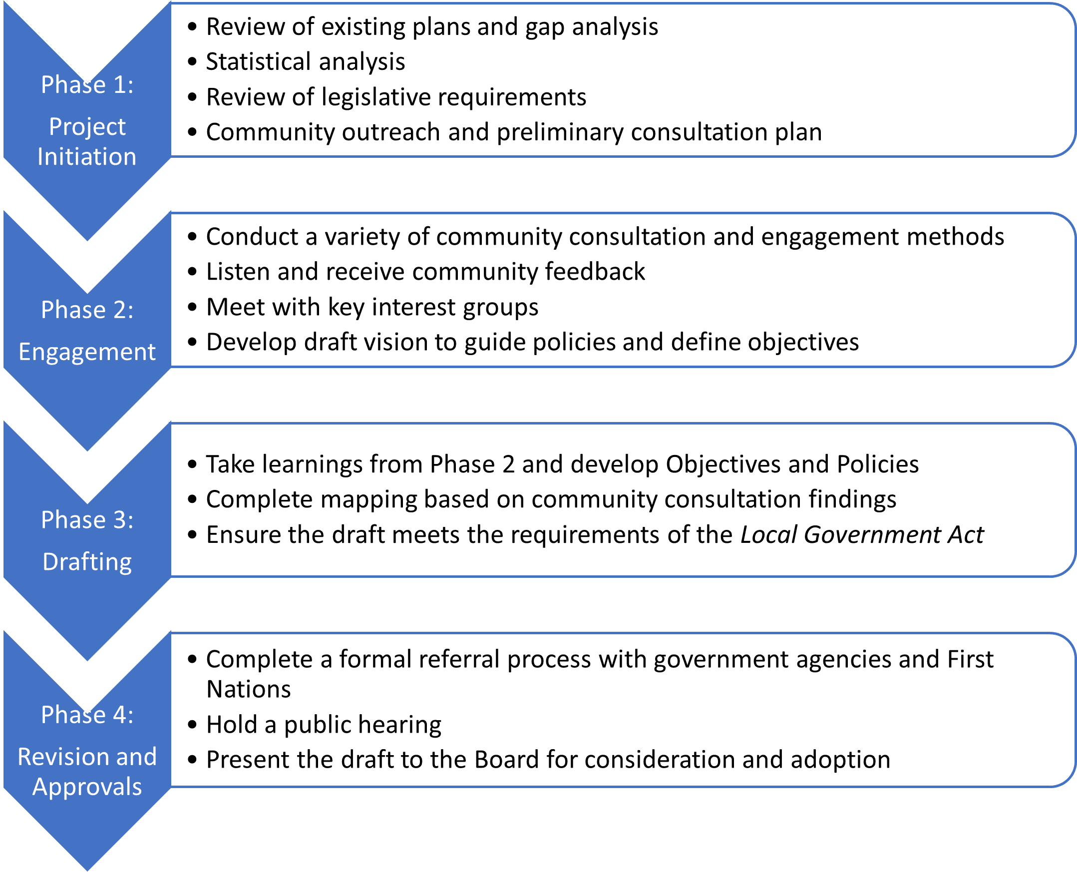
Where are we now?
The Area C OCP is in Phase 1.
If you live or work in the Outer Discovery Islands, we want to hear from you! Please join us:
Outer Discovery Islands Community Meeting:
Wednesday October 16th, 2024 @ the Surge Narrows Bunk House
11 am to 3 pm | This event is being held in-person only.
Questions?
Please contact SRD Planning Services at 250-830-6718 | planning@srd.ca